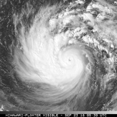
Super Typhoon Champi, 2026's strongest storm, nears Japan's southern islands
Super Typhoon Champi, the strongest storm on Earth this year according to The Washington Post, is heading toward Japan's Sakishima Islands, NHK reported. Japan's weather agency said it could blow down some houses there Friday and Saturday. The Washington Post said it is expected to weaken as it nears northern Taiwan.
Super Typhoon Champi is moving toward Japan's Sakishima Islands, according to NHK and The Washington Post. Japan's weather agency expects the storm to approach the islands from Friday through Saturday, NHK reported. The islands are part of Okinawa Prefecture in southwestern Japan, NHK said.
Champi became the strongest storm of the year when its winds reached about 185 mph on Tuesday, Scientific American reported, citing forecasters. The Post said its winds peaked at 185 mph, with gusts near 215 mph.
The agency said the typhoon could blow down some houses, NHK reported. It urged people in the region to prepare early. As of early Thursday Japan time, Champi had maximum sustained winds of 198 kilometers per hour near its center, NHK said.
Waves as high as 11 meters are possible around the islands, NHK reported. Up to 300 millimeters of rain could fall in the 24 hours through Saturday morning, it said. Officials warned of landslides and flooding.
Champi should hold its strength through Friday and then weaken as it nears northern Taiwan, the Post reported. A more direct hit is likely on Taketomi Island in Okinawa Prefecture, perhaps at near Category 4 strength, it said. The storm may later turn northeast and could affect western Japan, NHK reported.
Scientific American said the storm was expected to weaken over the next day or so, citing the National Oceanic and Atmospheric Administration.
Champi passed just south of Guam on Sunday, missing the island by about 20 miles, the Post reported. Its eye on Wednesday was wider than the state of Rhode Island, it said.
Warm ocean water of 86 to 88 degrees has helped the storm stay strong, the Post reported. Scientific American said El Nino has helped drive a busy storm season in parts of the Pacific.
What we know: Champi is expected to near Japan's Sakishima Islands Friday and Saturday.
What we don't: How strong it will be when it arrives and how hard it will hit Taiwan.
Where outlets agree Scientific American and The Washington Post report that Super Typhoon Champi peaked with winds of about 185 mph, making it the strongest storm on Earth this year.
Where they differ Scientific American, citing NOAA, reports that Champi had winds of 175 mph on Wednesday morning, while The Washington Post puts its sustained winds at up to 170 mph that morning.