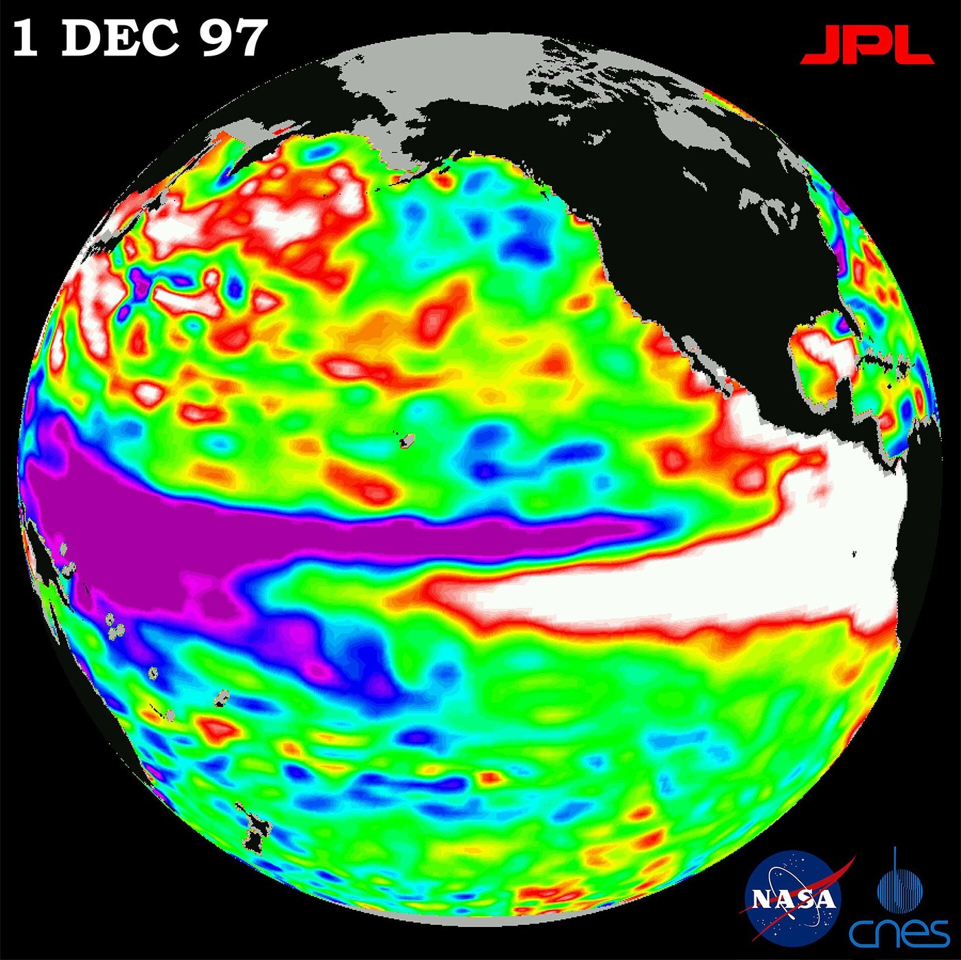
CPC: very strong El Niño odds top 90% into winter
NOAA’s Climate Prediction Center says El Niño is strengthening, with greater than 90% odds of a very strong event through fall and winter 2026–27. Eastern Pacific waters have run more than 3°C above average. The next monthly advisory is due Oct. 8.
El Niño is already roaring, not waiting on winter maps. CPC’s Sept. 10 diagnostic discussion — still the controlling monthly outlook into early October — keeps an El Niño Advisory in force and says the event is strengthening further. Sea-surface temperature anomalies exceeded +3.0°C in the eastern equatorial Pacific. Niño-3.4 sat near +1.8°C, Niño-3 near +2.5°C, and Niño-1+2 near +3.4°C, while subsurface waters ran more than 10°C above average at depth across wide stretches of the basin.
CPC’s outlook, blending North American and international models, shows El Niño continuing to strengthen through year-end. For October–December 2026, forecasters put a 75% chance on a historic-strength event exceeding +2.5°C on the relevant three-month index — stronger than prior events back to 1950 in that framing. Greater than 90% odds attach to a very strong event lasting through Northern Hemisphere fall and winter 2026–27. Atmospheric signs match: low-level westerlies, enhanced central-to-eastern Pacific rainfall, and suppressed rain over Indonesia.
Columbia’s International Research Institute posts a matching September 2026 ENSO quick look for model consensus readers. Impacts stay probabilistic. U.S. winter temperature and precipitation outlooks will shift as the event peaks; coastal communities should watch CPC seasonal maps rather than a single headline. Farmers, utilities, and emergency managers should treat the Oct. 8 CPC refresh as an operational product.
Alaska analyst Rick Thoman notes that mid-latitude jet-stream El Niño signals often crank up in late October and November — the same weeks when Arctic open water is still dumping heat. That collision of tropical and polar drivers is the season’s science story, not a guarantee of any named storm in your county.
What we know:
El Niño is strengthening with >90% odds of a very strong fall/winter event; eastern Pacific anomalies have exceeded +3°C; next CPC discussion is Oct. 8.
What we don’t:
Exactly which U.S. regions will see classic El Niño rainfall and temperature anomalies at peak.
Where outlets agree NOAA CPC and IRI’s September ENSO products agree El Niño is strengthening with very high odds of a strong event into winter 2026–27.
Where they differ Regional winter impact maps still differ on timing and magnitude even when the ocean signal is clear.