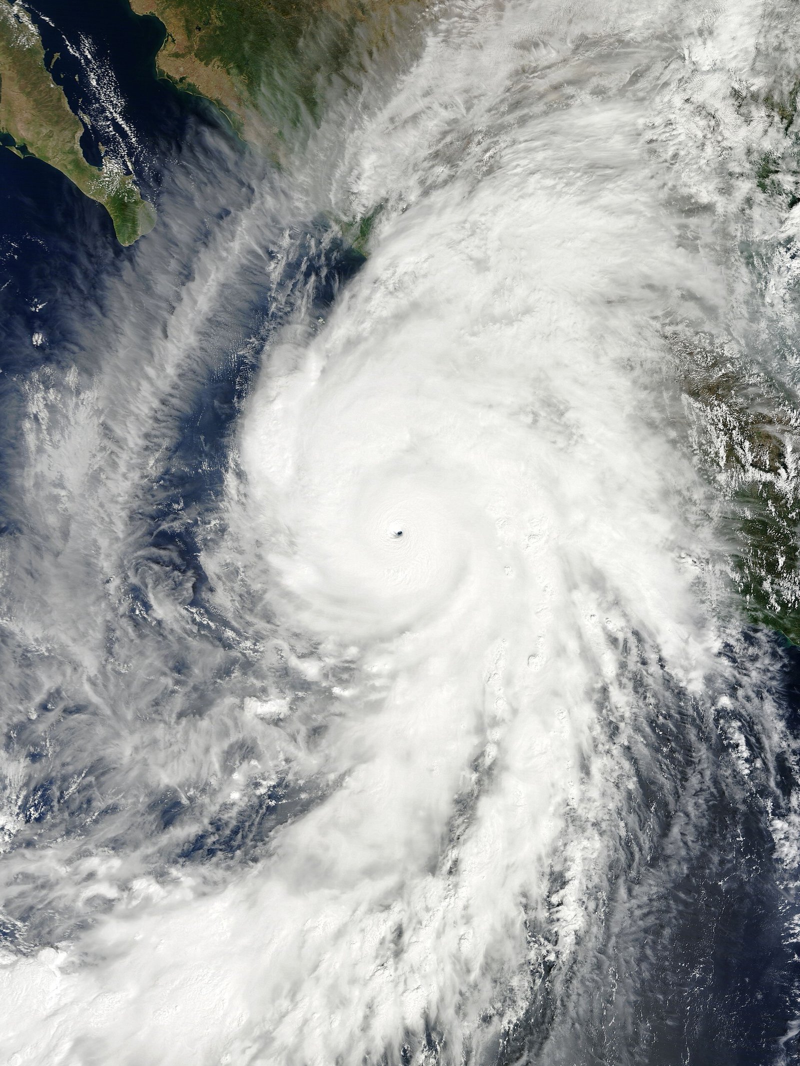
Hurricane Polo nears Category 5 off Mexico’s coast
NHC said Polo, a Category 4 with ~150 mph winds about 215 miles south of Zihuatanejo, could reach Category 5 Tuesday while paralleling Mexico’s Pacific coast. Moisture from Polo is also enhancing Southwest U.S. flood risk, especially in New Mexico.
Hurricane Polo rapidly intensified into a Category 5 storm off southwestern Mexico, with the National Hurricane Center reporting maximum sustained winds near 160–165 mph and a center roughly 205 miles south of Zihuatanejo—posing life-threatening flooding and mudslide risks along Mexico’s Pacific coast even if the eyewall stays offshore.
Reuters said Polo reached Category 5 earlier Tuesday and continued intensifying, classified as “extremely dangerous,” with some additional strengthening possible Tuesday night as a NOAA Hurricane Hunter aircraft investigated. A turn toward the northwest and west-northwest was expected Tuesday night and Wednesday, keeping the core near but likely offshore of Guerrero and Michoacán. Rainfall there threatens life-threatening floods and mudslides; lesser rains may affect coastal Oaxaca, Colima, and Jalisco. President Claudia Sheinbaum urged vigilance, saying available information pointed to skirting rather than direct landfall. Tropical storm watches and warnings covered stretches of coast; major ports such as Lázaro Cárdenas and Manzanillo face wind and rain impacts. AccuWeather noted possible effects toward Acapulco, Puerto Vallarta, and later southern Baja California Sur.
Fox Weather emphasized extreme rapid intensification—about 110 mph of wind increase in 24 hours, reminiscent of 2023’s Otis—and said Polo is the eastern/central Pacific’s third Category 5 this season after Genevieve and Lowell. Moisture streaming north is enhancing a U.S. Southwest flood threat, especially across New Mexico, where NWS Albuquerque warned of life-threatening flash flooding midweek after recent deadly flooding near Newcomb. Interaction with Tropical Storm Odalys could later alter tracks and moisture. Forecast uncertainty grows beyond five days regarding any Baja approach after weakening. Pacific hyperactivity contrasts with a shear-suppressed Atlantic under the same strong El Niño.