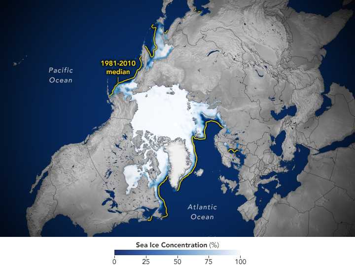
Arctic sea ice minimum ties for tenth lowest on record
Arctic sea ice likely bottomed at 4.60 million square kilometers on Sept. 12, tying 2008, 2010, and 2025 for tenth lowest in the satellite era, NSIDC said. The last 20 years hold the 20 lowest minimums. Antarctic ice neared a third-lowest winter maximum.
The Arctic’s melt season ended near the bottom of the modern record again. The National Snow and Ice Data Center reported that sea ice likely reached its annual minimum on Sept. 12 at 4.60 million square kilometers (1.78 million square miles), tying 2025, 2008, and 2010 for tenth lowest in nearly 48 years of satellite data. Every one of the 20 lowest minimums has occurred in the last 20 years.
This year’s floor still sat about 1.21 million square kilometers above the 2012 record low of 3.39 million, and about 1.62 million below the 1981–2010 average minimum — a loss on the order of Alaska’s land area. The long-term trend since 1979 is roughly 11.8% per decade relative to that baseline, or about 73,200 square kilometers lost per year on the linear fit. Scientists note the September minimum has flattened somewhat over the past two decades even while remaining far below pre-2007 levels — an active research debate, not a return to old ice.
NSIDC called the announcement preliminary because late-season storms can still compact low-concentration ice. In the Antarctic, ice likely peaked near Sept. 14 at 17.59 million square kilometers, on track for a third-lowest winter maximum if the date holds. A full melt-season analysis was due in early October. Shipping lanes, Indigenous coastal communities, and polar research camps feel the practical difference when late-summer ice thins, even in a non-record year.
What we know:
The 2026 Arctic minimum is about 4.60 million km² on Sept. 12, tied for tenth lowest; the last 20 years dominate the low end of the record.
What we don’t:
Whether a late storm revises the preliminary minimum, and how strongly this year’s El Niño shaped regional melt patterns.
Where outlets agree NSIDC and partner ice centers agree the 2026 Arctic minimum ties near the tenth-lowest mark in the satellite record.
Where they differ Researchers still debate how much recent flattening of September lows weighs against the multi-decade decline.